
POWER AND COMMUNICATIONS
We are using drones to help telecommunications providers mitigate dangers associated with asset inspections
TRANSMISSION TOWERS & POWER PLANT
VISUAL & THERMAL DRONE INSPECTION
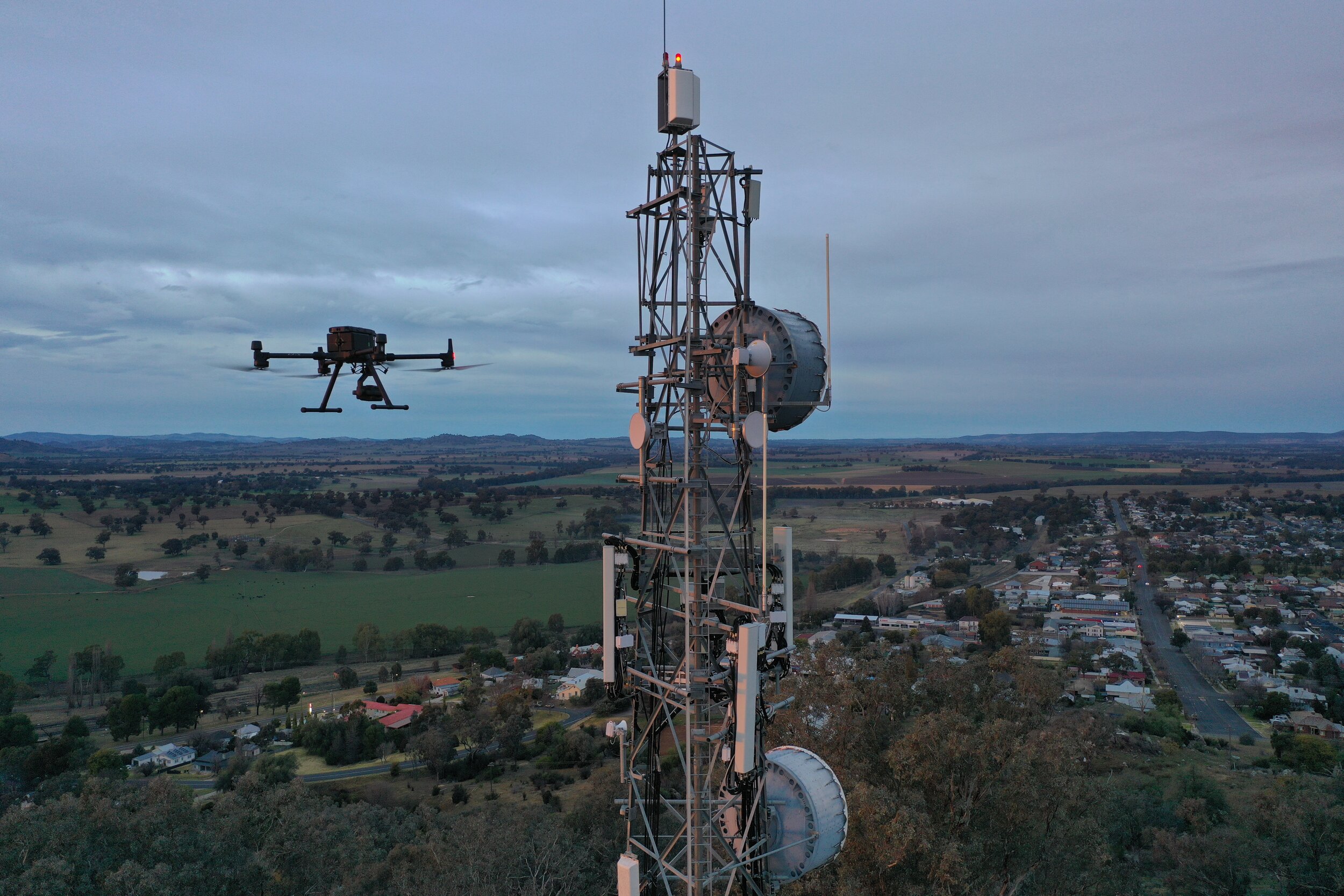
Drones can complete detailed inspections, capturing both thermal and RGB imagery. Teams will benefit from a higher level of detail – missing pins, rust, damaged insulators – compared to typical ground and helicopter patrols, and thermal imagery can quickly identify hot spots. The more detailed and accurate data delivered by a drone inspection can enable companies to proactively identify more defects, which could lead to fewer power outages and reduced repair costs.
With the use of partnered software, we can compile reports on each asset from images captured. All defects can be annotated on images with geotagging, which allows maintenance crew to locate the exact location of an identified fault.
Utility companies find that drone inspections significantly cut time and costs. For example, with a drone, substation inspections can be completed within an hour and no shut-down is required.

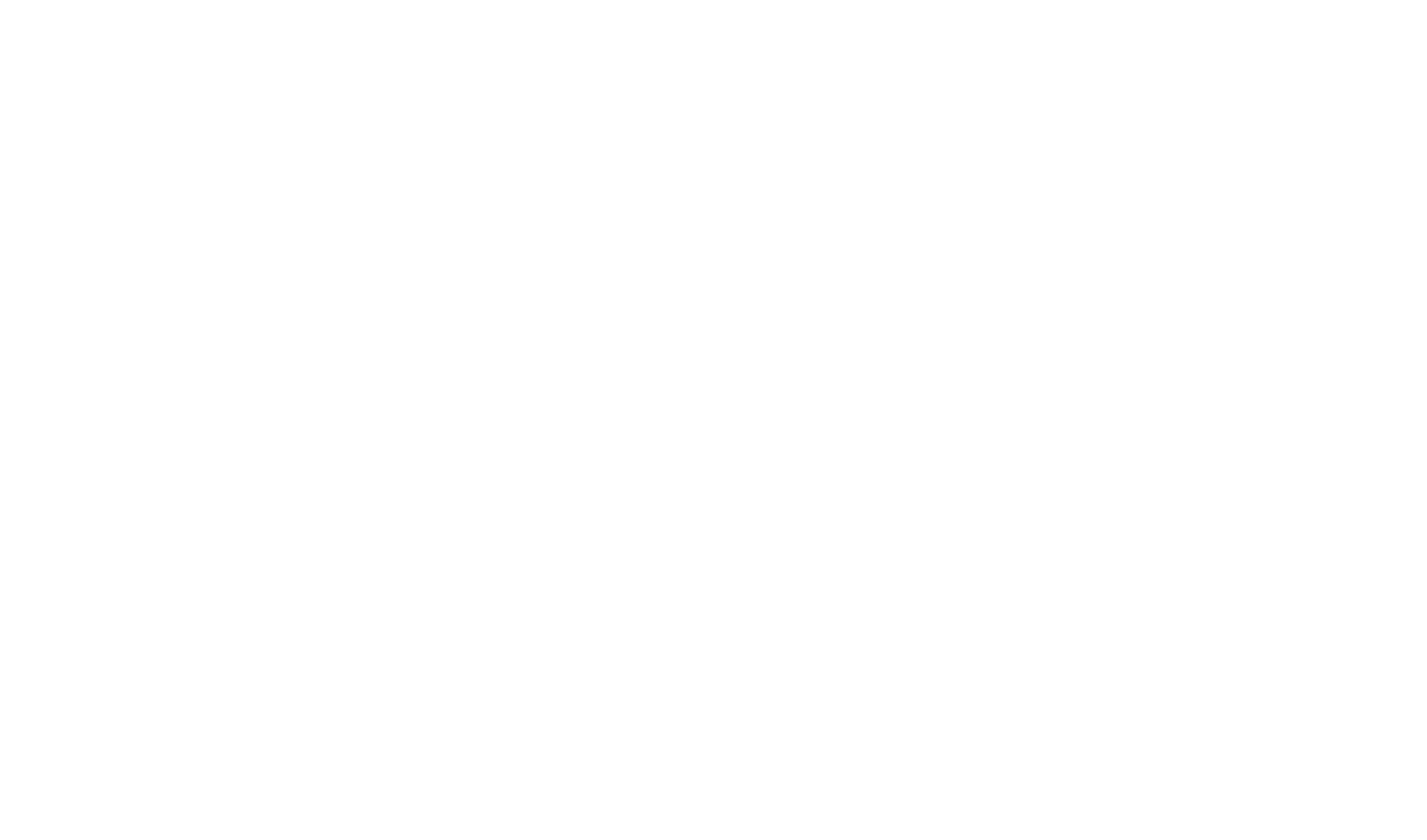
COMMUNICATION TOWER INSPECTION
Using drones and specialised software, we create digital twin 3D models that we can analyse for defects and use to collect measurements with millimetre accuracy. This provides asset-owners with a full report through visual imagery completely accessible from their desktop. Our data capture methods can create a highly accurate digital twin regardless of the type of tower or location.
We also offer Line of Sight surveys which can be used to locate link obstructions and assess any service impacts from up to 50km away.
Drone inspections allow our pilots to safely and efficiently inspect towers in a highly cost-effective manner by removing any danger from the inspection process. This means more inspections can be made for the same overall cost.
Additional benefits are:
Higher degree of detail in images and digital annotation of faults, makes it easy to decide on rectifying actions.
Pin-pointing the exact location of defaults is easy using geo-tagging and saves repair-crews time and trouble.
Sharing information with relevant stakeholders is effortless through customisable reports, sending single images or by granting outside stakeholders with access to the system.
Images are always safely and securely stored.
PHOTOGRAMMETRY - 2D/3D MODELS
Drones can capture high-definition photos at different angles, creating millions of data points, including georeferences, elevation points, and colours. By stitching these images together, we are able to create high-resolution 2D orthomosaics and 3D models allowing you to see more detail than traditional methods of surveying. This inspection method also allows you to trace back to the source high-resolution RGB images for further inspection clarity if needed.


LiDAR
We use LiDAR (Light Detection and Ranging) as a sensing method for mapping terrain and point cloud creation. Using partnered technology, we are able to efficiently map and model complex scenes or assets down to 3cm accuracy and 2cm precision.
LiDAR has significantly faster processing times and smaller file sizes than photogrammetry methods and therefore is a great alternative for mapping large areas or corridors.
From the surveyed area we can provide clients with Terrain models (DSM/DTM) and colourised point clouds (LAS) from simultaneous LiDAR and camera data capture.
Contact us to discuss whether LiDAR or Photogrammetry is right for you.

MORE SERVICES

Conductor Inspection
Thermal Imaging

Solar Inspection
BOOK A CONSULTATION
Get in touch to find out how we can help your business operate more efficiently and explore new opportunities to do things better